South Coast Region NDRRA Package
Principle – WSP Global (TMR)
Completion Date – January 2018
Project Scope – Engineering Surveying Techniques including U.A.V. (Drone) Surveying, Aerial Imagery and Engineering, Field Surveying, Service Locating and Geotechnical Investigations.
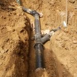
This project was undertaken for WSP Global as part of the South Coast Region NDRRA package on behalf of the Department of Transport and Main Roads (TMR). AHS was engaged to assess the extent of the damage sustained during a major flood event in order to assist in the rehabilitation of the sites to their original condition. Fifteen sites within the South Coast Region were assessed.
Related Posts

Subsurface Utility Engineering (SUE): Reducing Risk and Improving Projects
Construction and infrastructure projects across Australia face numerous challenges, from managing budgets and timelines to ensuring safety and minimising disruptions.
Read more
PUP Underground Locating: Essential for Safe Excavation
Excavation is a necessary activity which ranges from large infrastructure projects to smaller residential works.
Read more
Non-Destructive Digging: The Safe and Efficient Way to Excavate
Traditional excavation methods, involving heavy machinery and extensive digging, often pose significant risks to underground utilities, the environment, and worker safety.
Read moreTalk with us today to find out more
Please call and speak with one of our friendly members of staff or send us an email using our contact form